


 Research Article
Detection Technology of Groundwater Seepage Field Based on Seismic Electric Effect of Double Electric Layers
Received Date: November 26, 2024; Published Date: December 10, 2024
Abstract
The safe disposal of nuclear waste is a pressing concern domestically and internationally. Over ten millennia, nuclear waste migrates through cracks in the rock mass of the disposal reservoir and enters the living area of human beings, causing certain harm to ecology, environment and living range. How to distinguish and monitor its migration path and the seepage field of groundwater migration medium is a research hotspot. At present, there are different kinds of hydrogeological test methods for monitoring the flow velocity of groundwater, and their application is relatively mature. There is a lack of technology to measure the flow direction of groundwater velocity in the preselection area of Beishan high discharge disposal reservoir in Gansu Province, which is characterized by hard, low permeability and closed rock mass. This study employed a three-dimensional sonar vector seepage field tester to detect Xinchang and Zhouzhou faults in Beishan, Gansu province. The findings revealed that the groundwater flow velocity in Xinchang F31 fault and five nearby 100m boreholes is 10-10m/s, and the main seepage direction is northwest to southeast. The flow velocity of the groundwater in the three 10m shallow holes in the Zhouzhoujing fault pit is 10-10m/s, and the main seepage direction is from northeast to southwest. Among them, the abnormal mutation of permeability velocity is consistent with the development of regional structural fracture. By verifying and comparing hydrogeological data from Beishan, it is found that: In the pre-selected area of the high-level waste disposal repository, the permeability coefficient of rock mass is about 10-10m/s, and the velocity of groundwater is 10-10m/s, which is consistent with the velocity of groundwater measured in this experiment. The accuracy of seepage velocity reaches 10-10m/s, and the direction error of flow field is 0~ 2°. The technique has high accuracy, scientific and feasibility, and provides theoretical and technical insights for solving the problem of groundwater seepage field detection in environmental geotechnical engineering such as preselection area of disposal reservoir, dam, and foundation pit and oil storage.
Keywords: High-level radioactive waste disposal; Groundwater seepage field; Double layer seismic effect; Three-dimensional sonar; Permeability of fractured rock
Introduction
Hydrogeology plays a pivotal role in the process of situating high-level waste repositories [1]. After the disposal is closed and groundwater re-saturated, radionuclides may dissolve in groundwater and migrate to the biosphere with time and erosion of the engineering barrier by groundwater [2]. The flow direction of groundwater significantly influences and controls the nuclide return process to the biosphere. Numerous hydrogeological testing methods exist for detecting groundwater velocity flow direction both domestically and internationally [3, 4]. Among them, the use of isotope tracer technology to test the flow direction of groundwater velocity has been relatively mature [5-9]. Chen Jiansheng et al. used isotope tracer technology to detect the flow direction, velocity, vertical flow and other parameters of groundwater. The flow direction measurement error was less than ± 3%, and the velocity measurement range was 0.01~100m/d. In addition, Bao Guangfu et al. used hydro geophysical methods to measure groundwater velocity and direction, and verified its feasibility through hydrogeological data [10, 11]. Fan Jinglong used MODEL GFD4 groundwater flow velocity meter to determine the groundwater flow velocity in Taklimakan Desert hinterland [12]. Fu Yunmei et al detected seepage characteristics of groundwater in fractured rock mass based on distributed optical fiber temperature tracer [13].
The study and application of sonar technology by foreign experts and technicians started relatively early, with a history spanning nearly a century [14]. Traditional 3D imaging sonar technology can obtain the distance, horizontal, vertical and other information of 3D space targets. Three-dimensional acoustic imaging sonar system with real-time, clear and three-dimensional imaging is used to detect the underwater structures of water conservancy projects such as sluices and embankments. The results indicate that the three-dimensional acoustic imaging sonar system can work normally in many types of complex water quality environments such as zero visibility (muddy water) waters, and has strong applicability, providing an important technical means for rapid, effective and scientific detection of hidden safety hazards of underwater structures such as embankments and seawall water conservancy projects [15- 21].
Based on the theory of the seismo-electric effect of double layers, numerous scholars have investigated the theoretical relationship between seismic P-waves and double layers of underground porous media, and proved the application potential of seismo-electric exploration methods in the fields of natural earthquake prediction, engineering exploration and petroleum exploration through preliminary laboratory tests [22-24]. Three-dimensional sonar vector detection method for seepage field is based on the theory of double electric layer seismic effect, allowing for the detection of flow velocity and direction within underground aquifers. This enables the determination of aquifer permeability coefficients, seepage flow rates, and other hydrogeological parameters. This method has been successfully applied to reservoirs [25] and dam [26, 27], deep foundation pit [28], subway tunnels, ground link walls [29] and other applications in engineering investigation [30-35].
Therefore, in-situ measurement technology of hydrogeological parameters (such as velocity, direction and permeability coeffi cient) under natural flow field is currently a hot research topic. This paper discusses the principle of three-dimensional sonar logging technology based on seismic effect of double electric layer and finds that it has significant advantages over traditional hydrogeological methods, and its application in the site selection of high-level waste disposal bank is of great significance.
Geological and Hydrological Conditions of the Study Area
The study area is situated within the site selection zone for the Xinchang high radioactive waste disposal facility in Beishan, Gansu Province. Xinchang, covering an area of approximately 94 km2, is distributed in the form of east-west direction, with a length of approximately 20km from east to west and a width of approximately 5km from north to south (Fig. 1a). The Beishan area is high in north and south, low in middle, Beishan mountain in north, Qilian Mountain in south, and Hexi Corridor in east and west direction in middle, mostly with low hilly terrain. The high latitude and high altitude Gobi desert region is a typical temperate continental climate with minimal precipitation, significant evaporation, dry wind, annual average temperature of 4.4~8.4 ℃ , annual average rainfall of 55.1~73.1mm, and annual average evaporation of 2380.9~3538.0mm [12].
The groundwater in the study area can be classified into three types: mountain bedrock fracture water, gully depression pore fracture water and basin pore fracture water [36].Mountain bedrock fissure water is the main type of groundwater in the region, primarily distributed in metamorphic rock and granite areas, minimal precipitation, significant evaporation. The buried depth of groundwater level is affected by topographic fluctuations, and the buried depth of low-lying areas is generally less than 5m, and the higher terrain is mostly between 10 and 40m. The water-bearing spaces are primarily found in weathering cracks and structural cracks in bedrock (Fig. 1b). The depth of weathering zone can extend up to 30~80m. Water abundance in the area is significantly controlled by geomorphology, lithology and geological structure conditions. The water inflow of a single well is as little as 10 m3/d and as much as 1000 m3/d.
Inland areas receive water primarily through atmospheric precipitation infiltration and recharge, with an annual average rainfall ranging from 60 to 80mm. The amount of groundwater recharge through precipitation is minimal, and the distribution of water is uneven. Groundwater originates from vertical infiltration recharge, is enriched in gully and depression and fracture fracture zone, partly consumed by evaporation, and partly discharged downstream by runoff through gully and depression and fracture fracture zone, and finally flows to basin or discharge point, forming a complete cyclic and alternate groundwater dynamic system [37].

Methodology and Scheme
Considering the fault strike of Xinchang F31 and Shizujing and its possible influence on groundwater flow direction, 5 surface boreholes of F31 fault and 3 boreholes in deep tunnel of Shiyuejing fault were detected respectively, so as to collect groundwater seepage field parameters from surface to underground in a certain depth.
Seismic effect of double electric layers
The seismic effect of the double electric layer mainly exists at the solid-liquid interface of underground porous media containing fluid. In the initial state, the natural electric field is in balance, the fracture surface of the rock mass (especially the clay particles) usually adsorbed negative ions, and the positive ions are distributed on the filling solution interface in the pores, thus forming a double electric layer between the solid and liquid (Fig. 2a). Due to the connectivity between the cracks in the rock mass, the groundwater flow field will not be in a static state. The movement of the solution filled in the pores of the rock mass generates vibration, causing the relative movement of the positive ions on the interface of the pore solution and the negative ions adsorbed on the fracture surface of the rock mass, resulting in fluctuations in charge density. At this time, the pore liquid forms a micro current, and alternating potential difference and alternating electric field appear in different parts of the medium. This process is the basic principle of generating seismo-electric effects in the fluid channels of underground porous media [23].

Underground water bodies in a natural state produce vibrations while flowing through porous media, leading to the generation of a seepage field at the measuring point and a double electric layer signal at the solid-liquid interface. The size and distribution of the energy transfer of the electrical signal in the fluid can be accurately measured by the array of sonar detectors, and the direction of the sound source can be shown according to the spatiotemporal distribution of the measurement data. Simultaneously, by utilizing the distance and phase difference between the top sonar detector A and the bottom detector B in the direction of the seepage sound source, the particle velocity equation of the continuous seepage field is established. Thus, the measurement of water velocity field is realized (Formula 1). The instrument of 3D sonar velocity vector data acquisition is shown in Fig. 2b.

Where: L is the length of the propagation path of the sound wave between sensors, m; Xis the axial component of the propagation path, m; T BA, T ABis the propagation time from sensor B to A and from sensor A to B , s; U is the average flow rate of the fluid through the sound channel between sensors A and B , m/s.
Results and Analysis
Surface 3D sonar logging test in Xinchang area
To identify the natural groundwater seepage vector field and hydraulic gradient field with unified boundary conditions in the site selection area, the big data analysis results of sonar seepage measurement method are used to automatically generate 3D visualization of groundwater velocity, flow direction, discharge and other hydrogeological elements on the measurement site, providing technical support for the most important groundwater dynamics parameters in the site selection area. Xinchang F31 and F32 faults are normal left-lateral strike-slip faults with northeastward strike. The overall strike of the fault is 60° NE, the dip is southeast, the dip Angle is 70°~80°, and span approximately 25~30km. Based on the geological features of Xinchang, regional geological F31, F32 fault structure and different hydrogeological distribution units, 5 hydrogeological deep holes within 100m were selected for 3D sonar seepage hydrogeological logging (Fig. 3).

As depicted in Fig. 3 and Tab. 1, the five hydrogeological survey holes in the mountain area are symmetrically arranged along the upper and lower plates of the large fault dip of F31 respectively, and the vertical holes of F31-1 and F31-2 in the north of the F31 fault, F31-3 and F31-4 in the south and F31-5 in the east. These 100m deep hydrogeological measurement holes basically represent the seepage characteristics of various hydrogeological units in the fault tectonic belt and the eastern low-lying area of the measurement area and the analysis results of three-dimensional spatial sonar big data of groundwater velocity, direction and discharge in the study area.
Table 1: Overview of 3D sonar test holes in Xinchang area.

In other words, there are three-dimensional dynamic seepage cloud map of the natural seepage field of regional groundwater dynamics under unified hydrological boundary conditions, and the numerical isocontour plane imaging map of XYZ triaxial velocity, flow direction and discharge generated by clouds. Therefore, the hydrogeological characteristics revealed by five boreholes in Beishan and the measurement results of groundwater seepage are displayed. Through the analysis of horizontal seepage velocity and seepage direction of groundwater well logging, the groundwater seepage field in each measurement hole is clearly identified, and the relationship between permeability characteristics and recharge and discharge in different geotechnical penetration sections is clearly identified. Thus, the seepage distribution curves of each aquifer and groundwater are measured as shown in Fig. 4 and Tab. 2.

Table 2: Part data of 3d sonar test holes in Beishan site.

Fig. 4 shows the distribution curve of the penetration velocity of the five measuring holes along the measured elevation. It is evident that the seepage velocity of F31-4 is the largest, followed by several large velocity anomalies in hole F31-5. The average penetration velocity in the test hole is F31-4, F31-5, F31-2, F31-3, F31-1.

Fig. 5a and Fig. 5b are the visual imaging images comparing the column diagram of single-well flow rate and the spherical size of three-dimensional spatial flow rate of the five measurement holes in the area. The section permeability data is multiplied by the penetration velocity of each meter measuring point by the effective section width of a single hole by 50m, and the total section flow of the measuring area is 9.87E+04cm3/s. The order of the flow size is: 7.88E+04cm3/s for F31-4, 1.79E +04cm3/s for F31-5, 1.01E +03cm3/s for F31-2, 6.0E +02cm3/s for F31-1 and 3.81E +02cm3/s for F31-3. One hole of F31-4 accounted for 79.8% of the total seepage, and the largest F31-4 was related to the smallest F31-3 single hole seepage by 2 orders of magnitude (Fig. 5a). This indicates that the distribution of water in individual wells within the study area exhibits significant variability, with lower volumes observed in the northern region and higher volumes in the southern region, as well as lower volumes in the western region and higher volumes in the eastern region. For the specific water quantity distribution data, see Fig. 5b. The diameter of the sphere represents the flow quantity in the well, and the color represents the same flow quantity corresponding to the color of the same flow quantity, thus clearly displaying the flow distribution characteristics of all measurement holes and the flow quantity values at different spatial locations. Therefore, the contour map of flow rate at the boundary of the seepage field in Fig. 6 was generated.


Fig. 7 illustrates the primary flow direction of natural groundwater seepage through five boreholes, as deduced from Beishan hydrogeological logging. The length of each arrow in the diagram corresponds to the penetration velocity, while its direction denotes the flow’s trajectory. Notably, the prevailing flow direction is northwest to southeast. By corroborating and cross-referencing this data with drilling fundamentals, a more accurate representation of the fracture zone’s groundwater flow field can be achieved.
Underground tunnel testing in shiyuejing fault
The Shiyuejing fault shares similarities with the Xinchang F31 and F32 faults, both of which are left-lateral strike-slip normal faults with a Northeastward strike (Fig. 3 and Fig. 8), with a general strike of 60° NE, dip to southeast, and dip Angle of 70°~80°. The F31 and F32 faults tested in the new site represent the characteristics of groundwater seepage field within 100m of the surface, while the October pit exploration can represent the characteristics of groundwater seepage field deep underground. To investigate this further, ,three shallow hydrologic holes within 10m in the Shiyuejing borehole were selected for hydrogeological sonar seepage measurements. The positions of sonar measuring holes SW1~SW3 are shown in Fig. 8.

Table 3: Part data of 3D sonar testing holes in Shiyuejing Fault.


Fig. 9 presents a column diagram illustrating the section flow of the three measuring holes, with the sum of their section flows totaling 1.77E+00 cm³/s. As evident from Table 3, SW3 exhibits the highest section flow, followed by SW1, and then SW2, which has the lowest section flow.
As illustrated in Fig. 10, the average penetration velocity of each hole is ranked as 1.02E-10m/s for SW3, 7.28E-10m/s for SW2, and 6.72E-10m/s for SW1.

Conclusion
Comparison of penetration velocity curve and core of boreholes
(1) Among them, by comparing the permeability coefficient of hole F31-1 with that of the rock core (Fig. 11), it is found that the permeability coefficient in the hole detected by the well logging is relatively high in the test section, and the rock core is relatively broken. If the subsequent comparison and verification are made with the development of rock cracks in the hole revealed by the drilling TV, the underground water flow field and seepage law will be more truly detected.


(2) Fig. 12a and Fig. 12b are the flow velocity vector three-dimensional distribution diagram of each spatial measurement point of the seepage field of natural groundwater in 3 holes obtained from the hydrogeological logging of Shiyuejing tunnel and the plane main seepage direction diagram of each hole. The length of the arrow in the figure indicates the size of the penetration velocity, and the direction of the arrow shows the direction of the penetration velocity. Their main flow direction is from northeast to southwest.
By comparing and verifying the penetration velocity measured with depth by the TV imaging of the borehole and the three-dimensional sonar in the borehole (Fig. 12), it is evident that the penetration velocity value of the borehole ranges from 5.76×10⁻¹⁰m/s to 8.94×10⁻¹⁰m/s, with significant values observed at the depths of 1.5m, 4.5m, 7m and 9.5m respectively. A comparison of the TV data from the borehole reveals that fracture structural planes tend to develop at depths where groundwater velocity is high, and this correlation is strong.
Comparative analysis of geophysical interpretation results
Through the measurement of 5 deep holes and 3 shallow holes in Beishan area by three-dimensional sonar, the measurement, calculation and analysis of hydrogeological parameters of groundwater seepage field obtained can be seen:
1) In the five deep holes measured by the new field, the underground flow velocity, direction and flow chart measured by the natural flow field indicate a highly uneven distribution on both lane and vertical sections, and the size of the distribution of the seepage field is consistent with the characteristics of the geological geomorphology distribution, especially the abnormal mutation of the seepage velocity is consistent with the development of structural cracks here. There is a difference of two orders of magnitude between F31-4 hole and F31-3 hole. The difference between the maximum velocity and the minimum velocity of vertical section F31-4 hole is 4 orders of magnitude. The main percolation direction of each spatial measuring point of the natural groundwater measured by hole 5 is northwest to southeast.
2) According to the three-dimensional distribution diagram of the velocity vector direction of groundwater seepage field measured by boreholes SW1-SW3 in the borehole exploration of Shiyuejing fault and the plane main seepage direction diagram of each hole, it can be seen that the seepage velocity of the three holes is 10-10m/s, and the main seepage direction is from northeast to southwest.
3) Based on the distribution maps of the flow velocity and flow direction of groundwater seepage field detected by 5 boreholes in Xinchang and 3 boreholes in Shizujing exploration, it is evident that the main seepage direction of groundwater in Xinchang F31, F32 and Shiyuejing fault are all affected by the development trend of fractures formed by fault zones, particularly in F31. At the same time, it is found that the groundwater velocity and discharge are higher at the depth of fracture development, which is consistent with the borehole data.
The research group’s water pressure experiment data of the hole: The permeability coefficient of rock mass in the pre-selection area of the high-level waste disposal warehouse is approximately 10-8m/s, and the hydrologic data show that the hydraulic gradient of this section is 1%. According to Darcy’s law, the flow velocity of groundwater can be deduced to be 10-10m/s, which is consistent with the flow velocity of groundwater measured in this experiment, which proves that this method is indeed feasible.
Sonar logging based on seismoelectric effect
The permeability coefficient is a hydrogeological parameter used to evaluate water flow migration in rock fissures. If the seepage flow is laminar flow in the fracture of rock mass, Darcy’s law is satisfied, that is, the seepage velocity v is proportional to the hydraulic gradient i , and the expression is as follows:
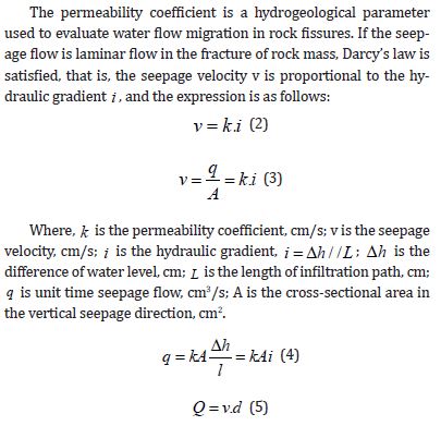
Where, Q is the section flow rate is the penetration velocity v of each measuring point multiplied by the water passing section area d, cm3/s; d is the water crossing section area, cm2. By substituting formula (2) and (3) into formula (4) and (5), we can get (6).

Thus, based on the velocity v of water in the fractures of the borehole wall acquired by the three-dimensional sonar logging device, the propagation time T of the sonar wave in the fractures, and the flow direction of water in Equation (1), the parameters of the groundwater seepage field exposed in the borehole can be derived.
Discussion
By applying the three-dimensional sonar vector measurement technology to the groundwater flow field measurement in the Xinchang preselection area, hydrogeological parameters such as velocity, flow direction and discharge of water in the interior of Xinchang and Shiyuejing fault zone are obtained, providing technical support for the most important groundwater dynamics parameters in the site selection area. Since most of the hydrologic test holes available in the site are 100m deep, most of the test data of groundwater velocity and direction are within 100m at present. However, according to the results of the preliminary regional engineering geology and hydrogeology investigation, the structure of strata at different depths in the site is less developed, and the lithology is granite. Therefore, the test results of this paper can be used as an important reference for the seepage field in the underground 500-700m range.
The research team’s continuous investigation and experimentation have revealed that three-dimensional sonar seepage flow detection technology, when compared to traditional methods such as pressurized water experiments for obtaining hydrogeological parameters like permeability coefficient, offers the advantages of being simple, fast, and reliable in field operations. This technology significantly reduces field workload while enabling the measurement of groundwater flow fields in the study area and the interpretation of multiple hydrogeological parameters, including groundwater flow direction, velocity, and rock permeability coefficient. It provides an effective means for quantitative analysis and evaluation of the permeability characteristics of structural formations in the field area.
Declaration of Competing Interest
There are no known conflicts of interest associated with this publication.
Acknowledgement
Foundation: The authors gratefully acknowledge support from the Beijing Research Institute of Uranium Geology (FZ2102202151) and the State Key Laboratory for GeoMechanics and Deep Underground Engineering, China University of Mining & Technology (SKLGDUEK2213). The assistance extended to this project by the Beijing Research Institute of Uranium Geology is also highly valued and appreciated.
Additionally, this paper represents the interim achievements of the general project (Grant No. 2024J1071) under the Yunnan Provincial Department of Education’s Scientific Research Fund, as well as the initial findings from the 2024 Young Scientists Fund of the Joint Special Project for Basic Research in Undergraduate Colleges and Universities in Yunnan Province (Award No. 202401BA070001- 008).
References
- Xiao Feng, Wang Ju, Guo Yonghai (2011) Progress of hydrogeological studies in Beishan preselected area of disposal repository for high level radioactive waste in China. Uranium Geology 27(3): 185-192.
- Deng Longchuan, Li Xiaozhao, Wu Yun (2021) Study on water conductivity characteristics of different scale structure surfaces in Beishan site area. Journal of Engineering Geology 29(1): 77-85.
- Yu Li, He Jibin, Ye Chengming (2021) Model test on seepage regular pattern of horizontal well in low permeability formation. Journal of Engineering Geology 29(5): 1515-1524.
- Zhou Zhifang, Wang Zhe, Li Yabing (2021) Calculating the permeability parameters of the staggered zone based on the nonlinear flow simulation of the high pressure packer test. Journal of Engineering Geology 29(1): 197-204.
- Chen Jiansheng, Du Guoping, Liu Aiguang (1996) Study on seepage field detection of dam foundation by isotope and natural tracer method. Jiangsu Journal of Agricultural Sciences (04):44.
- Jiansheng Chen, Haizhou Dong (2001) Study of fissured-rock seepage flow with isotope tracer method in single borehole . Science in China 44(1): 108-113.
- Gao Zhengxia, Xu Junhai, Wang Jianping (2003) Isotope technology and its application to measurement of groundwater velocity. Journal of Hohai University Natural Sciences 31(6): 655-658.
- Ren Hongwei, Liu Yaowei, Sun Xiaolong (2013) Advance of the technique to determine the velocity and direction of groundwater by single-hole isotope diluting and tracing method. Recent Developments in World Seismology (2): 5-15.
- Hamed Y, Ahmadi R, Demdoum A, et al. (2014) Use of geochemical, isotopic, and age tracer data to develop models of groundwater flow: A case study of Gafsa mining basin-Southern Tunisia. Journal of African Earth Sciences 100(6): 418-436.
- Bao Guangfu (2008) Determination on the flow velocity of groundwater based on hydro geophysical methods. West-china Exploration Engineering, 20(12): 156-158.
- Gu Xianping, Nie Xinshu, Zhou Jiang (2010) Groundwater Flow Rate and Direction Detecting through High Density Electric Method Instrument. Coal Geology of China 22(z1): 83-85.
- Fan Jinglong, Xu Xinwen, Lei Jiaqiang (2009) Measuring the velocity and direction of groundwater along Tarim Desert Highway. Geotechnical Investigation & Surveying 37(8): 51-55.
- Fu Yunmei, Deng Yanhui, Xie Yueqing (2022) Characterizing groundwater flow in fractured rock using fiber-optic distributed temperature sensing and numerical modeling. Journal of Engineering Geology 30(4): 1257-1265.
- Palmese M, Trucco A (2006) Acoustic imaging of underwater embedded objects: signal simulation for three-dimensional sonar instrumentation. IEEE Transactions on Instrumentation & Measurement 55(4): 1339-1347.
- Gerlotto, François, Georgakarakos (2001) The application of multibeam sonar technology for quantitative estimates of fish density I n shallow water acoustic surveys. Aquatic Living Resources 13(5): 385-393.
- Lu Liang (2010) Simulation research of imaging algorithm for 3-D imaging sonar. Harbin Engineering University.
- Xueming He (2012) 3D Sonar Imaging Technology in Underwater Vehicle. Journal of China Maritime Police Academy.
- Liu Dongsheng, Zhang Yuqing (2013) The application of sonar detection technology in a reservoir in a mining area. Coal Mining Technology (6): 77-79.
- Dai Linjun, Jiang Yuqiang, Zhu Zhenhua (2013) 3D Imaging Sonar Technology and its application in hydraulic engineering. Zhejiang Water Science and Technology 41(5): 54-56.
- Li Bin, Jin Lijun, Hong Jia (2010) Application of three-dimensional imaging sonar technology in detection of underwater structure. Journal of Water Resources & Water Engineering (3): 184-188.
- Wang Weiguo, Tian Kaiyang, Shi Yehui (2015) Sonar detection technology in the application of the engineering survey. Shanxi Architecture 41(21): 41-42.
- Fujimoto T, Awaga K (2013) Electric-double-layer field-effect transistors with ionic liquids. Phys Chem Chem Phys 15(23): 8983-9006.
- Su Wei, Liu Cai, Chen Chen (2006) Progress of seism electric in theory and research. Chinese Journal of Geophysics, 21(2): 379-385.
- Shi Kunfa (2001) Seismo-electric effect theory and preliminary experimental results. Chinese Journal of Geophysics 44(5): 720-728.
- Liu Di, LI Xuejiao, Yu Yanqiu (2013) Application of sonar seepage detection to the seepage point of Qiao Reservoir Dam. Haihe Water Resources (3):46-47.
- Tan Jiexiong, Du Guoping, Gao Dashui (2013) Application of sonar in seepage detection of Baiyun Hydropower Station . Yangtze River 43(1):36-37.
- Gao Dashui, Chen Yan, Du Guoping (2016) Application of sonar-seepage detection technology in sluices projects. Yangtze River 47(5): 73-75.
- Zhu Min, Guo Xiaogang, Deng Zhihcao (2015) Application of 3D sonar seepage detecting technology in deep foundation pit projects: Case of anchorage base of Miaozui Yangtze River Bridge at Yichang, Hubei. Yangtze River 46(17): 43-45.
- Yin Chaofan, Feng Yanling, Gu Jun, Tang Bibo, et al. (2016) Construction Technology of the Sonar Detection for Diaphragm Wall Joints before Excavation. Construction Technology, 45(s1): 71-75.
- Du Guoping, Du Jiajia, Song Xiaofeng (2019) 3D Velocity Vector Sonar Measurement System. Chinese Journal of Engineering Geophysics 16(3): 359-367.
- Du Guoping, Zheng Xilian, Wang Lv (2000) Measuring Velocity and Direction of Groundwater by Using Directional Aviation Techniques. Journal of Nanjing University of Aeronautics and Astronautics 32(4): 483-486.
- Du Guoping, Li Qing, Wang Ning (2012) Detection on the seepage field of primary branch and secondary lining of subway tunnel by sonar detector[C]// the ninth Annual Conference of the World Association for Rail Transit Development. Proceedings of the 9th Annual Conference of the World Society for Rail Transit Development 103-114. Beijing.
- Deng Hui, Shi Zhan, Xue Chen-jun (2015) The Application of Hydrogeological Sonar in the Jinjiang through. Architecture of Jiangsu (3): 55-56.
- Du Jiajia, Du Guoping, Cao Jianhui (2016 ) Study on visualized-imaging of sonar detection for measurement of high dams with large seepage. Dam & Safety, 94(2):37-40.
- Du Jiajia, Lu Jianfeng, Wang Zhen (2018) Control Technology of Sonar Seepage in Deep Foundation Excavation of Wuhan Green Land International Financial Center. Construction Technique 47(1):6-10.
- Li Renhai (2020) Measuring velocity and direction of groundwater in borehole and numerical simulation of groundwater in Beishan area, Gansu province. Chengdu University of Technology.
- Guo Yonghai, Yang Tianxiao, Liu Shufen (2001) Hydrogeological characteristics of Beishan preselected area,Gansu province for China’s high-level radioactive waste repository. Uranium Geology 17(3): 184-189.
-

This work is licensed under a Creative Commons Attribution-NonCommercial 4.0 International License.


